Newsletter Issue 4
December 2016

Newsletter | Issue 4 | December 2016
» View this newsletter as a PDF
Welcome to Edition #4 of the CGI Newsletter. In this edition we provide a look back at 2016 and a taste of what is to come in 2017.
Table of Contents
GeoSciML - OGC Accreditation
The GeoSciML data transfer standard was recently accepted by a unanimous vote of the Open Geospatial Consortium (OGC) Technical Committee. This significant milestone cements GeoSciML’s place as the international geological data transfer standard.
Documentation and schemas for GeoSciML version 4.1 will be available on the OGC and www.geosciml.org websites early in 2017. Due to some changes required by the OGC review process, GeoSciML will move from version 4.0 to version 4.1. The most significant change in version 4.1 is the renaming of GeoSciML-Portrayal to GeoSciML-Lite to avoid confusion with use of the word ‘portrayal’ in other standards domains. The only other changes from version 4.0 to 4.1 are minor bug fixes and improvements to documentation.
The considerable documentation required for OGC accreditation was compiled by Eric Boisvert of the Geological Survey of Canada, with assistance from Ollie Raymond (Geoscience Australia) and Marcus Sen (British Geological Survey). Many thanks for a great effort!
EarthResourceML-Lite
A new abridged, simple feature (WFS SF-0) version of the EarthResourceML data model was released by CGI in August 2016. EarthResourceML-Lite (or ERML-Lite) can be used to deliver simplified views on mineral occurrences and their commodities, mines, mining activities and mine waste products.
ERML-Lite has a similar purpose to GeoSciML-Lite, in that it enables delivery of a simplified view of the full EarthResourceML model which can be used for exchange of data in simple formats that can be easily rendered in GIS applications and web mapping portals (e.g., WMS, simple WFS, shapefiles, CSV tables).
2016 IUGS Science Excellence Award
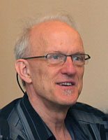
Dr Stephen Richard, recently of the Arizona Geological Survey and now at Columbia University, USA, was awarded the 2016 IUGS Science Excellence Award in Geoscience Information at the 35th Intern-ational Geological Congress.
Steve was a research geologist and Head of Geoinformatics at the Arizona Geological Survey from 1992 until 2016, but his influence on North American and international geoinformatics extends way beyond the borders of Arizona. Steve was a leading member of the North American Geological Map Data Model (NADM) Steering Committee from 2000 to 2007. He worked with this consortium of American and Canadian geoscientists, database designers, and developers of geologic map information to develop a comprehensive geological data model that would form one of the foundations for global standards development.
Steve was a founding member of the CGI Interoperability Working Group in 2004. As part of this group, Steve was a leading force for over 10 years in the development of the GeoSciML standard for geoscience data transfer.
Steve has also been deeply involved in development of international geoscience vocabularies through the IUGS CGI Controlled Vocabularies Working Group, and was the founding Chair of the CGI Geoscience Terminology Working Group. Over 30 internationally-agreed vocabularies were published under Steve’s leadership.
Steve has also been a leader in technical development of the US Geoscience Information Network (USGIN) - especially as chief architect of the US National Geothermal Data System - to deploy web services for geoscience information exchange. His advocacy of OGC and CGI standards in US geological surveys has led to these global standards being embedded in North American data delivery best practice.
Geoscience Vocabularies
The Geoscience Terminology Working Group (GTWG) has been working away compiling key vocabularies to support the GeoSciML and EarthResourceML geoscience data models. The CGI vocabulary service has been hosted by CSIRO in Australia from its inception, but is soon to be migrated onto a server hosted by Geoscience Australia. The GTWG is very appreciative of the efforts of CSIRO in developing and maintaining the vocabulary service for over a decade and thanks Geoscience Australia for agreeing to support the service into the future.
The important Commodity Code vocabulary was compiled and adopted in 2015; a highly hierarchically organised vocabulary of 291 terms describing natural and processed earth resource commodities. This vocabulary is showcased in the Minerals4EU Map Viewer web application for mineral commodities around Europe.
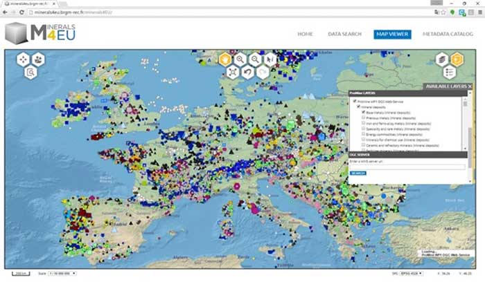
The EarthResourceML vocabularies have been translated into 22 other European languages through the INSPIRE directive and these multi-lingual vocabularies will be adapted for delivery through the CGI vocabulary service. Many more vocabularies are still required, particularly for the Extension schema of the GeoSciML model.
The Working Group is always looking for more active members to contribute to compilation of geoscience vocabularies, particularly in languages other than English. Contact the group’s chair, compose(‘M.Rattenbury’, ‘gns’, ‘cri.nz’, ‘Mark Rattenbury’);, if you would like to contribute to the work.
A Successful 35th IGC
A successful “Geoscience Data & Information Systems” symposium was held at the 35th International Geological Congress in Cape Town in August. Over 40 presentations were given on a wide range of digital geological data management, data analysis, and data delivery topics.
More than 20 people attended the CGI workshop on geoscience web services. Presentations were given by the leaders of all the CGI working groups, and experts from the OneGeology and INSPIRE projects.
News from Africa
The GIRAF Network was transferred fully into African hands at the 26th Colloquium of African Geology (CAG26) in Ibadan in November. The network coordinator since 2009, Dr Kristine Asch (BGR and CGI) ceremonially handed over the reins to Ibrahim Shaddad, Director of the African Mineral and Geosciences Centre in Dar es Salaam, Tanzania, where the new GIRAF office will be located.
“Knowledge-based geoscience information is more important than ever, especially in Africa”
said Kristine.
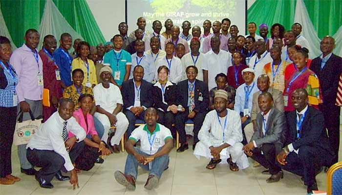
GIRAF was founded in 2009 as a platform for African geoscience information experts to share information and experience to understand the needs and issues in geoscience information management, delivery and technology in Africa. Its aim is to improve the environmental conditions and economic circumstances of Africa though the application of information technology based on geoscience data and information.
Since its inauguration, the network has been primarily supported by the German Federal Ministry for Economic Cooperation and Development (BMZ), BGR, UNESCO Nairobi, the Geological Society of Africa, AusAid (Australia), the United Nations Development Programme, the IUGS Commission for Geoscience Information (CGI) and many more organizations. GIRAF has more than 400 members from more than 30 African and 12 non-African countries.
News from China
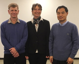
GeoSciML Standards Work-ing Group chair Ollie Raymond, and recent CGI Councillor Dr Kristine Asch visited the China Geological Survey (CGS) in Beijing in November to present a series of talks on geoscience information standards. Ollie and Kristine were hosted by Dr Zhang Minghua, Director of Geoinformation and Engineering at the CGS Development Research Center.
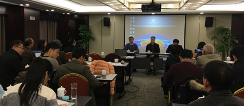
The presentations were attended by 30 staff from the Beijing and provincial offices of the CGS.
CGI Council News
A new CGI Council for 2016–2020 was sworn in at the 35th International Geological Congress in Cape Town in September 2016. Founding CGI member and CGI Secretary-General, Kristine Asch, left the Council to take up a role as a Vice-President of IUGS. Thank you Kristine for your many years of commitment to CGI.
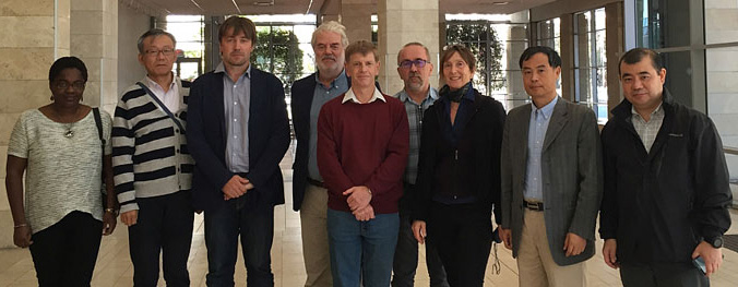
Kombada Mhopjeni (Namibia) and Zhang Minghua (China) were elected as joint Secretary-General, and Francois Robida (France) remains as CGI Council Chair. The Council also welcomed two new members, Tomasz Nałęcz (Poland) and Harvey Thorleifson (USA).
The CGI 2012–2016 four-year report was also submitted to the IUGS council at the 35th IGC in Cape Town. Read about all CGI’s activities and achievements over the past four years.
Upcoming Events
Geoscience Information Consortium — Vienna, May 2017
CGI will hold its annual Standards Working Groups and Council meetings in conjunction with the 32nd annual Geoscience Information Consortium (GIC) conference in Vienna, Austria, 29 May – 2 June, 2017.

GIC is an international forum to exchange information among Geological Surveys Organisations (GSOs) related to the use and management of geoscience information systems in support of the earth sciences.
Resources for Future Generations — Vancouver, June 2018
CGI has begun planning to have a substantial presence at the RFG 2018 conference in Vancouver, Canada, 16–21 June 2018. IUGS is a partner organisation at this conference. The conference will be a forum for industry stakeholders to discuss their research initiatives and activities as well as the key issues and trends shaping the future of energy, minerals and water resources including the science of the earth that underpins their sustainable discovery and extraction.
Meet Your CGI Councillors

Kombada Mhopjeni is joint Secretary General of CGI, and is Chief Geologist in the Regional Geoscience Division in the Geological Survey of Namibia (GSN). At GSN, Kombada has been involved in several mapping projects including detailed geological mapping in the northern and central parts of Namibia. She has also assisted in the maintenance and standardisation of geoscience data at the Survey. Her research interests are in the geological application of remote sensing and geoscience data management. Kombada has an MSc (Geology) from the University of Western Australia. Since 2008, Kombada has served as a committee member of the Geological Society of Namibia and has been involved in the organisation of conferences and workshops, including GIC-26 held in Windhoek in 2011. Kombada has keen interest in geoscience outreach and has partaken in several outreach activities including the International Year of Planet Earth (IYPE). Contact compose(‘kkmhopjeni’, ‘mme’, ‘gov.na’, ‘Kombada’); .
Featured Project
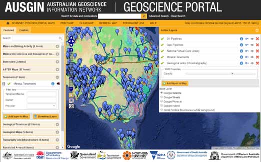
The Australian Geoscience Information Network (AusGIN) is a collaboration between the State, Territory and Commonwealth geological surveys of Australia. Its flagship is the AusGIN Geoscience Portal which delivers geoscience maps and data using OGC and CGI standards-based web services from all Australian governments through a single web mapping application.
Datasets available through the Portal include mines and mineral occurrences, boreholes, mineral exploration tenements, geological maps, and supporting infrastructure data layers. The Portal also enables users to search for further data and publications from the metadata catalogs of six Australian geoscience agencies using ISO and OGC catalog web service standards (CSW).
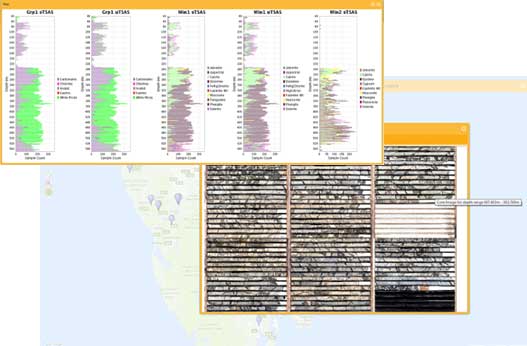
The Portal provides access to the National Virtual Core Library, a repository of high resolution photographic imagery and scanned hyperspectral data from borehole core. Users can view and analyse the hyperspectral data within the Portal interface or download the data for further analysis.
AusGIN is an enthusiastic supporter of the CGI data transfer standards, GeoSciML and EarthResourceML. AusGIN plans to be using the new EarthResourceML-Lite data standard for mineral resources web services, and GeoSciML v4.1 for borehole web services in 2017.
Join Us on LinkedIn
We invite all CGI members to join our LinkedIn group. The group provides a forum for CGI and LinkedIn members to connect with other geoscience professionals, post news of upcoming events, ask questions and discuss your issues.

