Newsletter Issue 1
Dec 2013
» View this newsletter as a PDF
Welcome to the new face of CGI. We will be posting out several newsletters each year to keep members up to date with the latest news and events in geoscience information. We hope you enjoy our new newsletter.
Table of Contents
Join us on LinkedIn

We invite all CGI members to join our new LinkedIn group. The group provides a forum for CGI and LinkedIn members to connect with other geoscience professionals, post news of upcoming events, ask questions and discuss your issues.
CGI Working Groups — old and new
At the recent CGI Council meeting in November in Denver, USA, the long-running Interoperability Working Group (IWG) headed by John Laxton from the British Geological Survey, was dissolved. However, that does not mean the work of John and the IWG members is over.
The IWG’s GeoSciML Task Group became a Standards Working Group of the Open Geospatial Consortium in January 2013, chaired by Ollie Raymond of Geoscience Australia. Future development and documentation of GeoSciML will be done under a collaborative arrangement between OGC and CGI.
Development of the EarthResourceML data transfer standard for mines and mineral occurrences will be continued by a new CGI EarthResourceML Working Group, headed by Jouni Vuollo of the Finnish Geological Survey.
Geoscience Terminology Working Group
The CGI’s Geoscience Terminology Working Group is looking for new members to help the global effort to publish multilingual vocabularies to support delivery of standards-based geoscience data.
If you would like to contribute to the working group, contact the group’s chair, Steve Richard. Read more about the working group.
EarthResourceML version 2 released
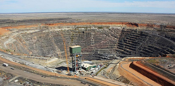
Version 2.0 of the CGI data standard for mineral occurrences and mines has been published. XML schemas and documentation are available from the EarthResourceML (ERML) website. A simple features version of the ERML standard - ERML-Portrayal - is also soon to be published by the CGI ERML Working Group. ERML is now fully compatible with the requirements of the European Commission’s INSPIRE data specification for Mineral Resources. Geological Surveys in Australia and New Zealand have also endorsed the ERML standard for delivery of mineral occurrence data.
GeoSciML-Portrayal version 2 released
Version 2 of the GeoSciML-Portrayal simple features WFS data standard was released in August. The schema provides a simple attribute structure for digital map portrayal of geologic units, faults, contacts, and now borehole collar locations. GeoSciML-Portrayal is also recommended for use as an attribute standard for WMS web services. The data standard is endorsed by several international data sharing initiatives, including OneGeology and the US Geoscience Information Network (USGIN). Find out more information on GeoSciML-Portrayal.
GeoSciML v3.2 “cookbook” published
A new instructional cookbook for GeoSciML web services has been published by CGI and the European Union’s INSPIRE Directive. Although the cookbook has been written mostly to address INSPIRE use cases, all users of the GeoSciML data standard will find it a useful guide.
New Managing Director for OneGeology
Marko Komac, Director of the Geological Survey of Slovenia, vice-president of IUGS, and CGI member, has been appointed as the new Managing Director of OneGeology.
The OneGeology initiative is a major partner of CGI in promoting interoperability and delivering geological map data using CGI and OGC data standards. Find out more information about OneGeology.
News from Africa
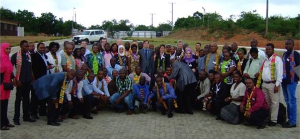
The 3rd GIRAF Workshop took place in Accra, Ghana, from 22nd to 27th of September, coinciding with the centennial celebrations of the Geological Survey of Ghana. 121 participants from 26 African and 7 non-African countries took part. The Geoscience InfoRmation in Africa network (GIRAF) was founded in 2009 and currently has 337 Members from 37 African and 15 non-African countries. GIRAF is governed by the CGI and is supported by the UNESCO.
The GIRAF-network brings together African scientists, authorities, national experts and other stakeholders in geoscience. GIRAF provides a platform to address, discuss and raise awareness of what geoscience information can do to - in the long-term - improve the way geoscience information contributes to the health and prosperity of the people in Africa.
Upcoming Events
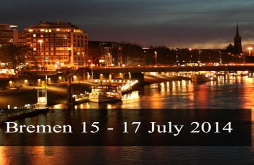
The FOSS4G Europe conference and exhibition will be held in Bremen, Germany, 15–17 July 2014. More than 500 delegates are expected to attend Europe’s largest ever event on free geospatial and location-based software. The winners of the NASA World Wind Europe Challenge will present their innovative applications at the conference.
Featured Projects
In each newsletter, we will be featuring an innovative geoscience informatics project from around the world.
If you would like to promote your project through CGI, contact CGI or tell us on the CGI LinkedIn group.
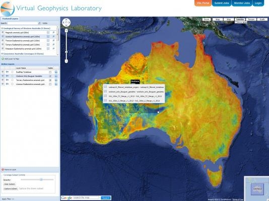
The Australian Virtual Geophysics Laboratory (VGL) is a scientific workflow web portal that provides geo-physicists with an integrated environment that uses cloud-based data processing applications and high performance computing technology. The VGL is an Australian government funded collaboration between CSIRO, Geoscience Australia, and the Australian National University’s National Computational Infrastructure (NCI).
Meet Your Councillors
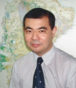
Gabriel Asato, from the Mining and Geological Survey of Argentina (SEGEMAR), has been a CGI Councillor for South America since 2008.
Gabriel has been the Manager of the GIS and Remote Sensing Unit at SEGEMAR since 1997. He has worked in the development of automated cartographic production systems and GIS standards in Argentina since 1994, and of the first Argentinean Geological Map Data Model. Gabriel participated in the Japan-Argentina GEOSAT-AR ASTER technology project in 2000-2004. At present, Gabriel is involved in projects including the Metallogenic Map of South America and the Argentine Satellite Atlas. Contact Gabriel.