Newsletter Issue 5
July 2017

Newsletter | Issue 5 | July 2017
» View this newsletter as a PDF
Welcome to Edition #5 of the CGI Newsletter. In this edition we report on the progress of the CGI Working Groups and the recent meetings of CGI members.
Table of Contents
A Busy Time for CGI
May and June was a busy time for many CGI members. Three of CGI’s standards working groups, the CGI Council, the OneGeology Technical Implementation Group, and the 32nd annual Geoscience Information Consortium (GIC) conference all met over a period of two weeks in Vienna, Austria and Orleans, France.
GeoSciML Standards Working Group
![]()
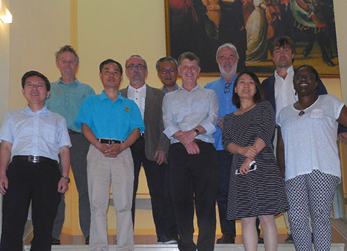
The OGC/CGI GeoSciML Standards Working Group (SWG) held its annual face-to-face meeting at Geologische Bundesanstalt (Geological Survey of Austria) in Vienna in May. This was the first meeting since the GeoSciML v4.1 data standard was ratified and published by OGC in March. All current documentation and schemas are now hosted on the OGC website. The original CGI website still maintains access to all historic versions of GeoSciML and links to other supporting resources like UML models and vocabularies.
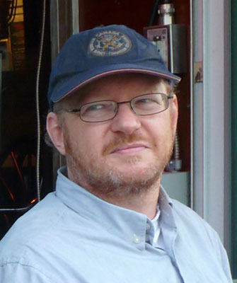
After 8 years as Chair of the Working Group, Ollie Raymond stepped down and Eric Boisvert (pictured) from the Geological Survey of Canada has taken on the role. We wish Eric and the team every success as the SWG enters a new phase in GeoSciML development. The working group discussed minor corrections to the version 4.1 standard, considered a GML version 3.2 profile of GeoSciML-Lite, and reviewed the best practice of delivering data using the GeoSciML-Lite data standard.
Members also considered the future direction of the SWG, in particular towards potential new standard encodings of the GeoSciML data model, such as RDF and JSON.
Towards a New Version of ERML
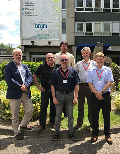
The annual EarthResourceML (ERML) Working Group meeting was held in June in Orleans, France, hosted by BRGM. CGI members from France, Finland, Australia and New Zealand attended the one day meeting.
The working group discussed a proposal from Geoscience Australia for a modification to way that the ERML-Lite data standard delivers commodity resource and reserve amounts. This request was based on the Australian and New Zealand experience of recently establishing the world’s first ERML-Lite WFS services.
The EU-funded ProSum project also presented a proposal to extend the ERML full model. The proposal will add Processing Activity and Processing Plant to the model. Other technical changes, including links to GeoSciML v4 and implementing recent GeoSciML modelling patterns, will be added to the EarthResourceML and after a review and voting period, a new version ERML v 3.0 will be published later in 2017.
![]()
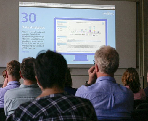
CGI intends to have a strong presence at the RFG2018 conference in Vancouver in June 2018, in particular to promote ERML and ERML-Lite to North America. New ERML and ERML-Lite implementations and use cases will be demonstrated there. Documentation and schemas for EarthResourceML v2.0 and EarthResourceML-Lite v1.0 are available on the www.earthresourceml.org website.
Geoscience Vocabularies
The CGI Geoscience Terminology Working Group (GTWG) met for its fourth face-to-face meeting at the Geological Survey of Austria in Vienna on May 26. Twenty-two people participated in person or remotely. Several key vocabularies that are in advanced stages of preparation have been prioritised for completion, notably the Natural Geomorphologic Feature, Mineral Deposit Type and Regional Lithological Unit Synthesis vocabularies.
A presentation by Chris Schubert from the Austrian Climate Change Centre outlined development on federated registries of vocabularies in Europe, and has helped confirm that GTWG’s role in providing globally-relevant geoscience terms that can work in parallel with geological surveys’ more local vocabulary requirements.
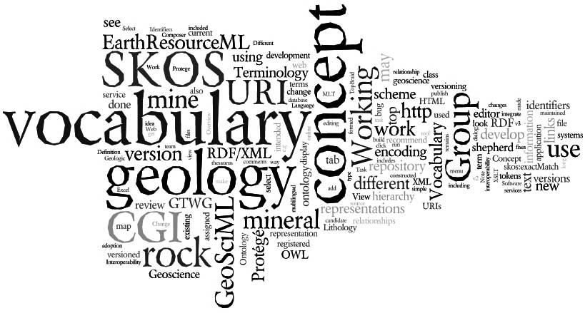
The CGI Vocabulary Service, hosted by Australia’s CSIRO for around a decade, is in the process of being moved to its new hosting organisation, Geoscience Australia. As part of the move to new hosting arrangements, all 2016 editions of CGI’s vocabularies are also incorporated in the Research Vocabularies Australia vocabulary service, a broader science vocabularies service that is available online globally.
News from Asia
CCOP Workshop on IGDP and Compilation Technology
A cooperation project between China and the Southeast Asia Geoscience Program Coordinating Committee (CCOP) on Integrated Geological Data Processing (IGDP) was kicked off at a workshop hosted by the China Geological Survey (CGS) on 22–24 May in Beijing.
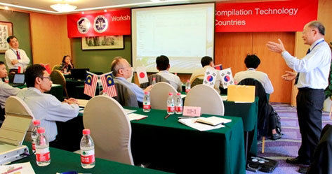
The workshop included training for CCOP member countries on data processing techniques for geological, geophysical and geochemical data. Twenty participants from Cambodia, China, Indonesia, Japan, Korea, Malaysia, Vietnam and the CCOP Technical Secretariat joined a discussion on OneGeology geological map data delivery technologies, and regional geoscience map compilation techniques. A work plan for the next two years was prepared.
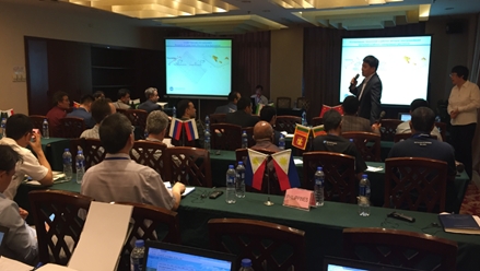
Information Sharing for the ‘Belt and Route Region’
A seminar was held at the China Geological Survey in Beijing on 16–20 May, 2017, aimed at geoscience information sharing amongst the vast region of the so-called the ‘Belt and Route Region’. The region, coined by the Chinese government, covers part or all of Oceania, Asia, Europe, Arab and Africa. More than 50 officials and experts from different geological organisations exchanged views and shared current technology for data exchange and information sharing. CGI-IUGS standards and the CCOP metadata standard will be used for data transfer once the cooperation project application is approved by the Chinese government.
News from South America
Ibero-American Open Science Meeting in Buenos Aires
An international Seminar on Open Science was held in Buenos Aires, Argentina from May 31 to June 2. The seminar was organised under the auspices of the Ibero-American States Organizations, Portugal, Uruguay, and the Argentina Ministry of Science and Technology. Science, technology and innovation agencies from Spain, Brasil and Colombia also participated.
The seminar discussed ‘Open Science’ to enable collaborative research and knowledge distribution by digital means. In particular, the regional science community see it as a way to improve science and technology development and performance in South America.
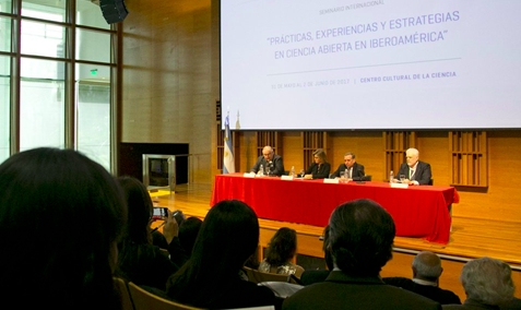
The meeting was focused mainly on open digital repositories. In this context, not only will written publications be reviewed, but also their supporting data and results. It is hoped that in the future this initial step by Latin American countries will facilitate the access to and development of interoperable data and methods for any kind of scientific data. The regional science community intends to facilitiate the development of initiatives currently occurring at different levels and domains in international organisations like IUGS CGI, ICSU, and the Research Data Alliance.
CGI Standards in New Zealand
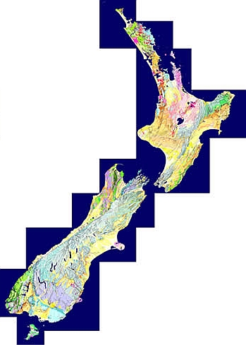
GNS Science, the New Zealand government geoscience agency, is just one example of a data provider embracing CGI data standards.
As mentioned in the EarthResourceML news above, an EarthResourceML-Lite-compliant web service of New Zealand’s mineral occurrences is available (see gns:GERM_ERML_VIEW). Two New Zealand geological map datasets — the 1:1M Geological map of New Zealand and the 1:250k Geological Map of Southern Victoria Land (Antarctica) — are now available as GeoSciML Lite-compliant web services, have been accredited with 4-star OneGeology status, and can be accessed from the GNS web service interface. The layers include links to CGI codelists for age terms, unit types, representative lithology and metadata records.
The 2017 version of the QMAP 1:250 000 Geological Map of New Zealand seamless GIS dataset contains links to CGI code-lists for age terms, unit types, representative lithology and metadata records amongst others. New Zealand’s Petlab Geoanalytical Database of rock and mineral properties has also incorporated CGI vocabulary terms for rock names and geological age.
CGI Council News
The CGI Council held its 2017 annual meeting in Vienna in June.
The councillors addressed:
- activities for CGI funding in 2017–18
- planning for the RFG 2018 conference in Vancouver next year
- a proposal for the coordination of hydrogeology data standards development in CGI and OGC
- the need to recruit and rejuvenate active membership in CGI working groups
- better promotion of CGI activities and standards
32nd Annual GIC Conference
The Geoscience Information Consortium (GIC) is an annual gathering of information managers from international government Geological Survey agencies. The 32nd GIC Conference was held from May 29 to June 3 at the Geological Survey of Austria (GBA) in Vienna. Many CGI members attended, and shared their work with Geological Survey representatives from 35 countries from every continent.
The conference heard a wide range of presentations on current best practice in data management and data delivery from many individual Geological Surveys, as well as collaborative data sharing initiatives from around the world. Panel discussion sessions also shared the experiences and requirements of the Geological Surveys in managing and delivering 3D geological models, future data management strategies, and emerging technologies.

Government Geological Survey information managers are encouraged to join the 33rd annual GIC conference which will be hosted by Geoscience Australia in Canberra, Australia in mid 2018.
Upcoming Events
Resources for Future Generations — Vancouver, June 2018
CGI cordially invites its members to the RFG 2018 conference in Vancouver, Canada, 16–21 June 2018. IUGS is a partner organisation at this conference and CGI encourages all its members to at the conference to demonstrate how CGI’s standards and best practice in data delivery and analysis supports and enables sustainable resource discovery and exploitation. It is anticipated that the use of web service data delivery, in particular using the EarthResourceML and EarthResourceML-Lite data transfer standards, will be a feature. The conference will be a forum for industry stakeholders to discuss their research initiatives and activities as well as the key issues and trends shaping the future of energy, minerals and water resources.
Meet Your CGI Councillors
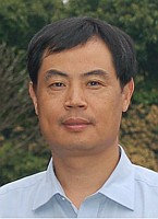
Dr Zhang Minghua is co-Secretary General of CGI and Director of Geoinformation and Engineering at the Development Research Center of the China Geological Survey. Zhang has a MSc and PhD from the China University of Geosciences, Beijing and has conducted post-doctoral research in GIS in geological exploration at the Beijing University of Science and Technology. Zhang also previously worked at the Institute of Geophysical Exploration, Ministry of Metallurgy, and the Chinese Academy of Geoexploration. Zhang has been project leader and a key researcher of Chinese national geoinformation projects since 2000, including geophysical and geochemical exploration software development, CCOP geoinformation metadata standards, CCOP/ASEAN geodata processing, and is currently the leader of China’s participation in OneGeology.
Zhang is also a senior member of several Chinese professional organisations, including council member of the Chinese Geophysical Society, Deputy Secretary General of Exploration Geophysics Committee of the Geological Society of China, Geoinformation coordinator of China to CCOP, and council member of the Geophysical and Geochemical Standard Committee of the Chinese Ministry of Land and Resources. Contact Zhang.
Featured Project
The European Plate Observing System (EPOS) is a long-term plan to facilitate integrated use of data and facilities from distributed research infrastructures for solid Earth science. It aims to establish a comprehensive multidisciplinary research platform for the Earth sciences in Europe. EPOS aims to facilitiate the integration of a wide range of heterogeneous data and services, including seismology, volcanology, geology and surface dynamics, geodesy, geomagnetism, analytical and experimental laboratory research, rock physics and petrology, and satellite information.
European CGI members are engaged in EPOS workshops and hackathons with a view to having an operational infrastructure by 2020. IUGS and CGI data standards will no doubt play a large role in enabling data transfer to and from EPOS researchers.
Join Us on LinkedIn

We invite all CGI members to join our LinkedIn group. The group provides a forum for CGI and LinkedIn members to connect with other geoscience professionals, post news of upcoming events, ask questions and discuss your issues.